

Camargue gardoise: a map does not prove fish passage
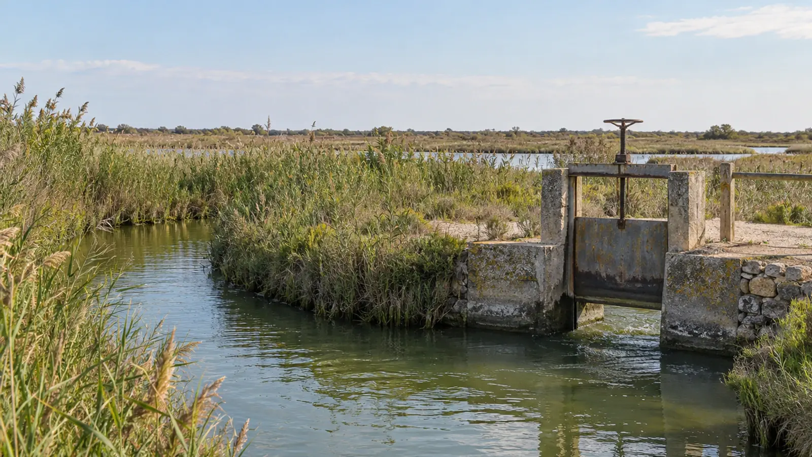
A marsh connected to the sea on a map can still be difficult for fish to enter or leave. The 2026 Camargue Gardoise assessment brings together water-control structures, management uses and hydraulic compartments. It provides a basis for decisions, while leaving actual fish passage and habitat suitability to be assessed.
- Content type
- Scientific news
- Sector
- Environment
- Animal group
- Fish
- Keywords
- SalinityTemperatureOxygen
A blue line on a coastal-marsh map may represent a channel whose exchanges depend on water levels, gates and management decisions. For a fish, the route available is determined by those conditions at the time it moves. Entering a compartment and leaving it later therefore need to be considered as parts of a functioning system.
Céline Bernard’s 2026 engineering dissertation brings these issues together for Camargue gardoise in southern France. The work was undertaken with CEN Occitanie/Pôle-relais lagunes méditerranéennes and the Syndicat Mixte de Camargue Gardoise; its findings were shared by Pôle lagunes on 1 October 2026.
An inventory that also identifies missing knowledge
The assessment combines fish records, water-quality information and details of water-control structures. At the Tour Carbonnière marshes, field visits supplemented maps, aerial photographs and managers’ knowledge. The report states that 35 visited structures were entered into GeObs, the interface used to register barriers to water flow.
It also shows how little passage information was available in the compiled records. Among 176 structures, six had an assessment of suitability for upstream migration and four for downstream migration. Those numbers describe the information recorded in the database used for the work. They are not counts of all structures that fish can pass.
Some locations could not be visited because of private access, vegetation or the position of structures. Missing information must therefore remain distinct from an absent structure or an established conclusion about its effect. Making these gaps visible helps direct subsequent checks rather than allowing a complete-looking map to imply complete knowledge.
Read the marsh as connected hydraulic compartments
The report delineates coherent hydraulic units, known by the French abbreviation UHC. These are marsh compartments distinguished by their water-level functioning and physical boundaries, such as embankments or raised tracks. A structure can connect two compartments, regulate their filling or allow water to move in only one direction.
This adds information that surface area alone cannot provide. A large wetland may contain several compartments with different uses and connections. Opening one structure may affect a sequence of areas, while closing another may interrupt the route to the sea. Functional diagrams help examine that sequence instead of treating each gate as an isolated point.
Connectivity consequently depends on each structure’s position in the network, condition and operation. A refurbished gate, a flap-valved culvert and a breach do not create equivalent exchange conditions. Field records should distinguish directly observed features, information supplied by others and unresolved assumptions.
Water exchange and fish passage need different evidence
For fish that use both marine and inland waters during their life cycle, connectivity needs to be considered in both directions. Upstream and downstream migration are different movements. Conditions that permit entry at one time do not necessarily provide an exit later.
The dissertation draws attention to compartments that fish may enter during inundation and become trapped in after operations change. That makes the relevant sequence entry, continued use of the habitat and the opportunity to leave. Finding fish inside a marsh does not establish that all three parts of the route function successfully.
At Tour Carbonnière, two structures are proposed as priorities for improving connections involving the Vieux Vistre and neighbouring channels. This is a management proposal derived from the assessment. The report does not provide measured passage rates before and after an intervention, or demonstrate effectiveness for every species and body size.
Evaluating an improvement therefore starts by defining the intended result. Is the question whether a connection is available, whether animals move through it or whether they use the habitat beyond it? These require different observations. A water-level change cannot automatically serve as a biological measure of fish passage.
Consider the habitat reached as well as the route
Opening a connection also brings water masses into contact. Salinity is an explicit management concern in these coastal marshes. Exchanges can alter conditions in the receiving compartment and interact with reed-bed management, agricultural uses and flood prevention. The report does not support a general instruction to keep every gate open permanently.
Dissolved oxygen, temperature and the duration of inundation also matter to habitat suitability. Fish may reach an area that later becomes unfavourable during hot conditions or drying. The value of a connection needs to be assessed alongside those conditions and the opportunity to move elsewhere.
Monitoring can bring together structure condition, opening and closing periods, water measurements and fish observations. Dates and exchange direction are essential when interpreting a single field visit. If operations change, updating the management record is as necessary as updating the map.
These observations do not produce one operating rule for the whole marsh. They support discussion with site managers and other stakeholders. Proposals need to consider the species of interest, their movements, hydraulic constraints and the conservation objectives that coexist in the same wetland.
Turn the map into a question that can be tested
The 2026 assessment provides a structured basis for prioritising further knowledge and action. The connections represented and the uncertainties identified guide subsequent checks. The next useful observation depends on what a decision lacks: the condition of a structure, its seasonal operation, actual animal movement or the quality of the water and habitat beyond it.
A mapped connection is therefore a starting point for a shared assessment. Keeping its evidence and limitations visible makes it easier to distinguish an improvement in hydraulic knowledge from a demonstrated benefit for fish.
Vetofish offers environmental managers advice and practical support to connect field data, water quality and fish-health questions. Defining the useful observation first helps teams assess the effect of a connection or management change without assigning it an unmeasured biological outcome.


