

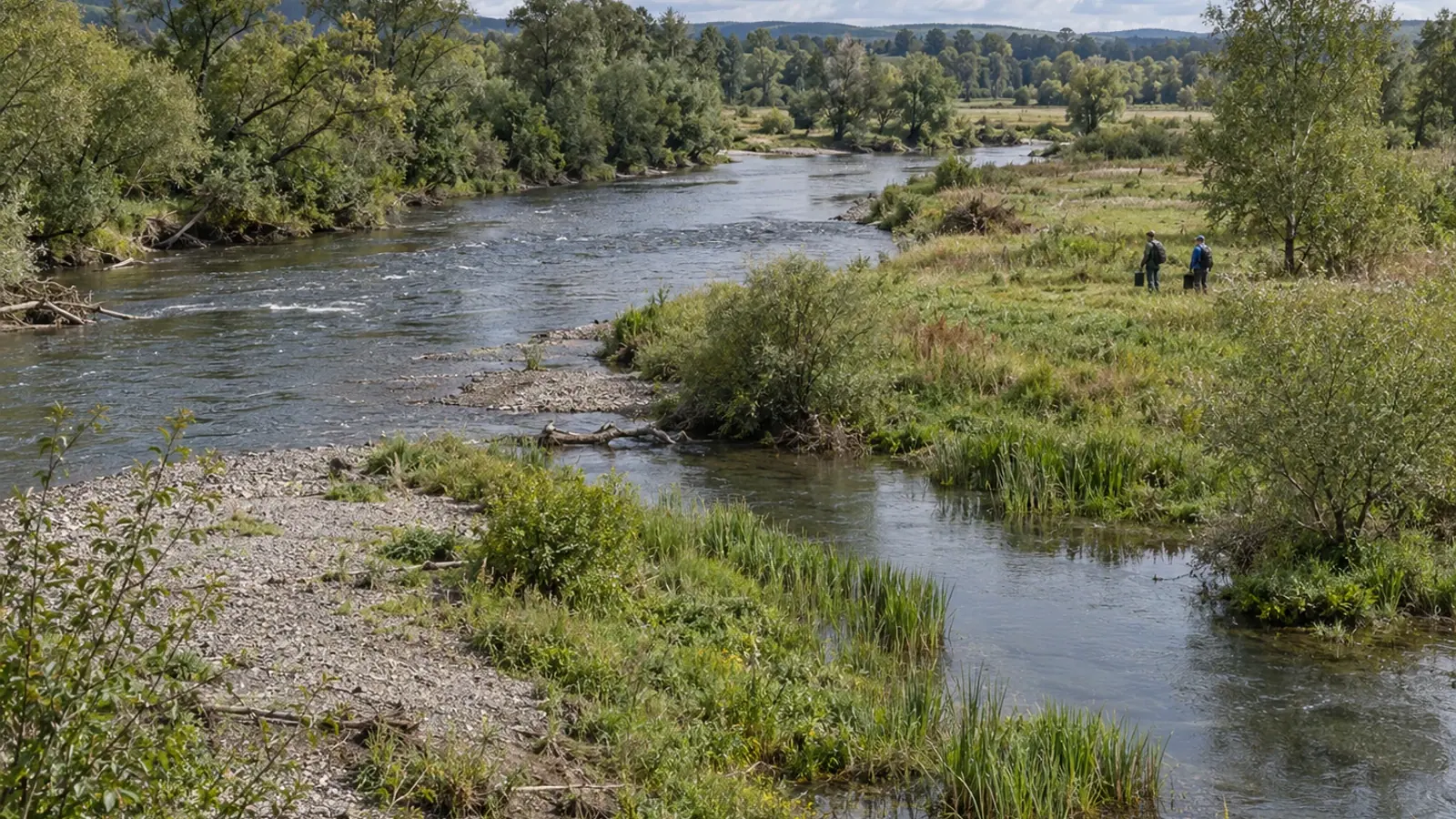
Freshwater restoration: from global maps to local evidence
A global map published in 2026 combines aquatic and neighbouring terrestrial areas to guide restoration planning. A mapped priority still needs to be tested against local pressures and ecological monitoring before fish benefits can be claimed.
- Content type
- Scientific news
- Sector
- Environment
- Animal group
- Fish
- Keywords
- TemperatureOxygenReproduction
Choosing where to restore freshwater environments requires several scales of evidence. A floodplain visible on a map may prove intermittently connected, subject to land-use constraints or affected by pressure originating upstream. For aquatic animals, the practical question is more specific: which function is missing, for which species and life stages, and under what conditions could an intervention restore it?
Hashemi and colleagues published a global mapping framework in Nature Water in January 2026. It identifies areas associated with freshwater systems to help make protection and restoration targets spatially explicit. The study does not measure fish population improvements following works, nor does it directly rank individual local projects by their expected fisheries benefit. Keeping that scope clear makes the map more useful to project planning.
Looking beyond the water’s outline
The authors combine land-cover classification at 30-metre resolution, hydrological networks and floodplain models. Their framework includes headwaters, river margins and floodplain areas, with narrower and broader delineation scenarios. These choices influence the areas represented and the opportunities considered. The map therefore incorporates methodological decisions rather than providing a single unquestionable boundary around freshwater value.
A catchment provides an initial scale for interpretation. Flows connect locations that may seem distant from a proposed construction site. Work confined to one river reach may not address a pressure arising upstream. Mapping helps place a site within these relationships, but it cannot by itself identify the cause of a local degradation or show that the proposed works address it.
Habitat means the conditions used by organisms. Inclusion within a mapped category does not establish access for every species or suitability for every life stage. Pixel size, source datasets and acquisition dates remain relevant when the map is used in a planning meeting. A visually precise boundary should not imply finer ecological knowledge than the underlying information provides.
Establish the function before choosing the intervention
A floodplain can retain landforms produced by a river’s earlier activity without being regularly flooded today. Lateral connectivity concerns exchanges between the river and adjoining environments. A reconnection proposal therefore needs information about water levels, timing and barriers. The outline of a mapped floodplain cannot establish when an aquatic animal could actually enter or leave it.
Riparian vegetation likewise needs a functional objective beyond the number of trees planted. Managers should identify the intended role, site conditions and compatibility with the existing environment. The study stresses ecologically appropriate interventions and avoiding unsuitable afforestation where forest would not naturally occur. A restoration label does not make every planting scheme appropriate.
That distinction matters for wetlands and open habitats. A carbon storage objective is insufficient by itself to justify converting a habitat. The proposal should identify what will be protected or restored, and which other functions might be affected. Global prioritisation offers a framework for considering opportunities; it cannot resolve these site-specific trade-offs without additional ecological evidence.
Write a hypothesis that can be assessed
For a local project, set out the chain of reasoning: the identified pressure, affected function, proposed intervention, expected response and measurement. Reconnection might be considered to restore access to an adjoining waterbody. Staff still need to establish whether water is present at useful times and whether access leads to conditions suitable for the intended animals.
Temperature and dissolved oxygen contribute to that environmental description. Their measurement alone does not show that fish use the habitat or that a population is increasing. Conversely, an occasional observation of fish says little about conditions throughout the season. Choose observations around the hypothesis instead of accumulating separate indicators without a common question. Specify whether the project concerns access, feeding habitat or a reproductive function, and which life stages it targets.
Keep feasibility visible but distinct from ecological priority. Permissions, access, maintenance, other uses, costs and responsibilities can shape delivery. A site with substantial ecological importance may require a different timetable from an uncomplicated construction project. Separating ecological interest from delivery conditions helps prevent ease of implementation being mistaken for expected biological benefit.
Design the evaluation before work begins
France’s Office for Biodiversity presents a minimum scientific monitoring framework for hydromorphological restoration. It combines a baseline, post-intervention monitoring and control stations to help distinguish effects of the works from wider river changes. Physical, chemical and biological compartments contribute different information. The framework is a useful example of planning evaluation before a project removes the opportunity to observe its starting condition.
Its stated scope includes criteria concerning watercourses, project dimensions and intervention types. It is not automatically a protocol for every wetland or restoration scheme, either in France or elsewhere. Outside that scope, comparative design and traceability remain useful principles, while the actual monitoring plan needs to fit the site, question and applicable local requirements.
Hydromorphology concerns a river’s physical characteristics and dynamics. Improvement in that compartment does not necessarily produce an immediate biological response. The French agency notes that responses after restoration vary and that missing baselines or short monitoring periods complicate interpretation. A photograph of completed works records an intervention, but does not evaluate its ecological outcome.
Keep priority and demonstrated benefit separate
The global study brings together areas often considered separately and helps locate restoration objectives. It does not demonstrate local effectiveness for every possible intervention. Global estimates of area or potential should not become promises about one site. A mapped opportunity needs further investigation before it can support a claim about animals benefiting from a particular project.
A better documented decision combines mapping, field assessment, identification of pressures and monitoring planned before work starts. Managers can then explain why the site was chosen, which function they aim to restore and how they will assess the result. Respecting the limits of the evidence does not make the map unusable; it specifies the next information needed.
Vetofish offers aquatic environment stakeholders advice and support concerning aquatic animal health and welfare, environmental measurements and monitoring criteria. This contribution complements the hydrological and ecological expertise needed for the project, without promising a population increase.


